A second heatwave arriving hot on the heels of the UK's current scorching mess could send temperatures spiralling close to 40C, turning weather maps black and crimson.
The last few days have seen the mercury increase exponentially, with temperatures surging upwards from highs of 24C last week to 31C on Thursday - a dramatic increase of nearly 10C. Despite some slight relief on Friday, temperatures are again expected to rise on the weekend, beating the already noteworthy highs as the southeast hits 32C. The sweltering conditions could look like child's play in less than a month's time, however, with a menacing 39C forecast looming on the horizon.
READ MORE: Major heatwave water warning for seven areas as Brits urged to act immediately
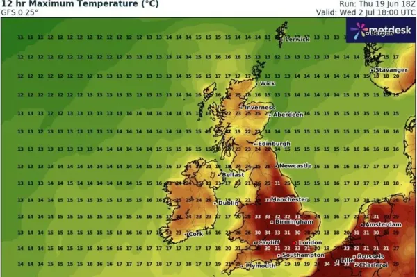
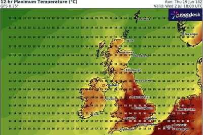
The latest maps from WXCharts show that, once the current heatwave runs its course this weekend, another will start developing just over two weeks from now. The maps for July 3 show extreme temperatures from continental Europe will cross the English Channel, sending temperatures back to the high 20C-low 30C range widely.
Typically chillier Scotland will heat up to 27C, while southern and central parts of England and Wales will bathe in uncomfortable 30C to 39C highs. But, unlike the latest heatwave, the worst of the heat blast seems most likely to hit central England, with the Midlands warming up to a stifling 39C.

Birmingham, Wolverhampton, Tamworth and Leicester, among several other towns in that immediate area, will shoulder the burden of the blowtorch blast. People living further south won't get much relief in comparison, with highs rising to between 34C to 37C on the south coast, and between 30C to 38C from the Welsh border to London.
Even areas further north of Birmingham will feel the heat, with temperatures in Liverpool and Manchester heating up to 37C, and the northeast coast to between 31C and 38C.
While it doesn't mention specific temperatures, the Met Office long-range forecast, which covers June 25 to July 4, does warn of more "occasional very warm weather", with "bursts of hotter air" set to push towards the UK from Europe.

The forecast states: "Rather changeable conditions are anticipated through this period, as a series of Atlantic low pressure systems pass largely to the northwest of the UK. These will tend to bring some occasional rain or showers, most frequent in northwestern areas where it may also be rather breezy or windy at times.
"Whilst some rain or showers will be possible farther south and east, here longer drier spells are more likely, under the influence of higher pressure."
The forecast adds: "There is also the chance of some occasional very warm weather, as south or southwesterly winds allow brief bursts of hotter air to encroach from the continent, but probably fairly short-lived and perhaps also accompanied by a few thunderstorms at times."
-
Israeli forces eliminate Palestine Corps commander Izadi, IRGC drone chief Joudaki

-
Yoga's Global Impact Highlighted by Lok Sabha Speaker Om Birla
-
Youth Congress Leaders Detained Amidst Protests in Rajasthan

-
Bihar's Political Landscape Heats Up with a Fierce Poster Battle Ahead of Elections

-
Netanyahu's gamble on Friday the 13th
